The low-pressure area over East-Central Bay of Bengal has become ‘well-marked,’ and the latest outlook indicates that it would go on to become not just a depression but further into a deep depression.
A deep depression is second only to a tropical cyclone in intensity, and, in this manner, the ‘low’ would have strengthened three times rapidly to attain this status by Thursday.
Landfall by Thursday night
The system would move west-north-west towards North Andhra Pradesh and South Odisha coasts and cross the coast between Kalingapatnam and Puri during late Thursday night or early Friday morning.
India Met Department (IMD) has forecast heavy rain over the North-Eastern States, Coastal Odisha, Coastal Andhra Pradesh, Telangana, Rayalaseema and Tamil Nadu and Puducherry on Wednesday. Thunderstorms accompanied with lightning may line up over over Coastal Andhra Pradesh, Telangana, Interior Karnataka, Konkan, Goa and Madhya Maharashtra.
‘Rough’ to ‘very rough’ (wave heights between eight ft and 20 ft) have been warned of over South and Central Bay, Andaman Sea and along and off Andhra Pradesh, Bengal and Odisha coasts. Fishermen are advised not to venture into these areas.
As for tomorrow (Thursday), the rains may grow in intensity with heavy to very heavy rain accompanied by extremely heavy falls lashing Odisha and North Coastal Andhra Pradesh.
Heavy rain forecast
It would be heavy to very heavy over Chhattisgarh and Telangana, while being heavy over the plains of Bengal, Jharkhand, Rayalaseema and Karnataka. Thunderstorm accompanied with lightning is likely at isolated places over Coastal Andhra Pradesh, Telangana and Interior Karnataka.
Forecasts for the next three days is as follows.
Friday: Heavy to very heavy rain over Odisha, Vidarbha and Chhattisgarh, while it will be heavy over Assam, Meghalaya, plains of Bengal, Jharkhand, Madhya Pradesh, Konkan, Goa, Madhya Maharashtra, Marathwada, Telangana and Karnataka.
‘Rough’ to ‘very rough’ sea conditions are possible over West-Central and North Bay and along and off Andhra Pradesh,West Bengal and Odisha coasts.
Saturday: Heavy to very heavy rain over East Rajasthan; heavy over Assam, Meghalaya, West Uttar Pradesh, Uttarakhand, Haryana, Chandigarh, Delhi, Himachal Pradesh, Madhya Pradesh, Konkan, Goa, Madhya Maharashtra, Marathwada and Vidarbha.
Withdrawal on hold
Saturday: Heavy to very heavy rain for Uttarakhand, Haryana, Chandigarh, Delhi, Punjab and Himachal Pradesh and heavy rain over West Uttar Pradesh and Rajasthan. In this manner, the rains penetrating right into West Rajasthan would have forced the withdrawal scheme for the South-West monsoon from Rajasthan back to the drawing board.
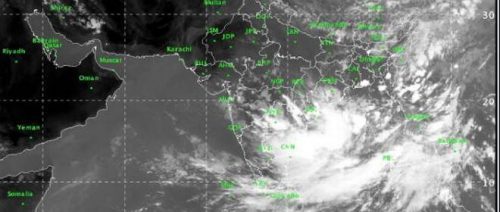
Earlier in the morning, the US Joint Typhoon Warning Centre had located the causative ‘low’ over East-Central Bay of Bengal to 714 km South of Chittagong in Bangladesh.
IMD had not referred to the scope strengthening of the depression until Wednesday noon, apparently because the sea-surface had not warmed much beyond the threshold 27-29 deg Celsius. But vertical wind shear values, which refer to sudden change in wind direction with height that unsettles a building system, are low to moderate at 37 km/hr.
They tend to be high during an active monsoon which is why tropical cyclones are rare during that phase of the monsoon. But cyclones tend to develop during the monsoon transition phase. For this reason, the sea behaviour is closely monitored during the months of May (just ahead of the onset of the South-West Monsoon) and September-October (ahead of the North-East monsoon).


